You can add a vector feature to a map containing a 3D surface. When you display the map in 3D, AutoCAD Map 3D toolset automatically drapes the vector on the 3D surface.
Note:
This exercise uses the AnalyzeMap1.dwg map you created and modified in the previous exercises.
To add roads to the map
-
Click
 .
.
- In the Data Connect window, under Data Connections By Provider, select Add SHP Connection.
- Click
 next to the Source File field and navigate to the folder where you copied the sample files.
 - In the Open dialog box, select ROADS.SHP and click Open.
- In the Data Connect window, click Connect.
- In the Data Connect window, click Add To Map.
- Close the Data Connect window.
To style the roads in the map
- In Display Manager, select the Roads layer and click Style.
- In the Style Editor, click the Style entry.
- In the Style Line dialog box, change Color to dark gray.
- For Select Symbol, select a dashed pattern for the lines.
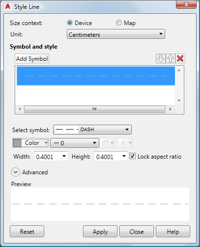
Select a dark gray, dashed pattern for the roads.
- Click Apply and then Close.
- Close the Style Editor.
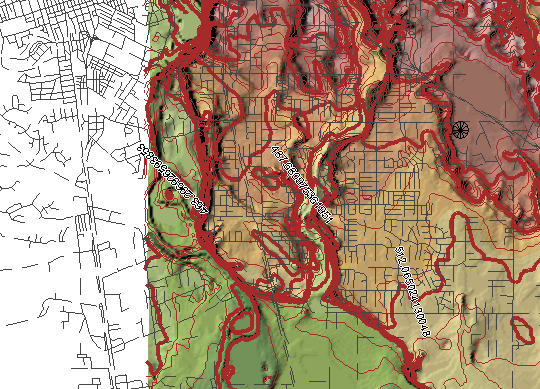
Your map now contains the styled surface and road layers.
To continue this tutorial, go to Exercise 4: Drape a parcel layer on top of the surface.