The drawing layers in your DWG file become the feature classes in the new schema. The object data properties in the drawing determine the properties for each feature class. Use the Properties palette to see the object data.
This exercise uses the DWGMap.dwg map file you opened in Exercise 1: Examine the original drawing layers.
To view the object data fields
- In the map, zoom in close enough to see individual objects.
Use the zoom commands on the View tab.
- Click View
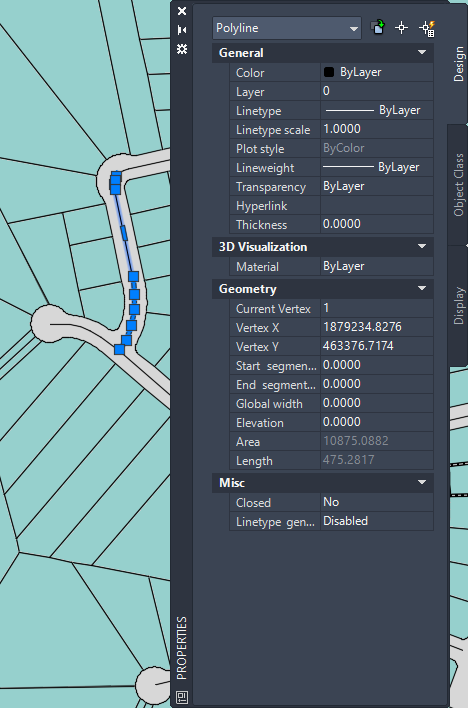
 PalettesProperties.
 - Select one of the pink polylines.
- Notice that the color for the polylines is ByLayer. Check the lower area of the Design tab of the Properties palette to see the object data.
The pink polylines represent parcels and have object data related to address, area, value, and so on.
You might see different information, depending on which polyline you selected.
- Press Esc to deselect the polyline.
- Pan, if necessary, to see the red lines in the upper left-hand corner of the map.
- With the Properties palette still open, select a red line.
The red line represents a waterline. Notice that the color for this line is not ByLayer. Within the layer, color has been used to indicate a particular type of waterline. In this case it indicates size. Red waterlines have a diameter from 26 through 48 inches.
- Deselect the red line and pan to the lower right side of the drawing.
- Select a green line.
The green line is also a waterline, but it is a different size. Green waterlines are from 13 through 24 inches in diameter. Blue waterlines are from 1 through 12 inches in diameter.
- Press Esc to ensure that no objects are selected.
The Properties palette displays “No selection” in the top field when you deselect all objects.
- Close the Properties palette.
To continue this tutorial, go to Exercise 3: Export the drawing layers to SDF - Select the layers