In addition to the geometric properties available in AutoCAD, AutoCAD Map 3D toolset has user-defined properties called object data.
You can use object data as you would regular AutoCAD properties. For example, use object data:
- As the basis of a query
- As the content for annotation
- As the criteria for styling (using themes)
- When exporting to another data format
You must have AutoCAD Map 3D toolset to create object data, but anyone who uses the free Autodesk® Design Review software can view it. For example, a field worker can view a DWF™ version of a sewer map in Autodesk® Design Review. To see information about a sewer pipe, the worker holds the cursor over that pipe. The information is available without obscuring the map itself.
The drawings in this tutorial have object data tables with information already entered. In this exercise, you use object data as a query condition. In a later exercise, you use object data to create feature classes in a new data format.
To create a query based on object data
- If the Redding.dwg map from the previous exercise is not still open, reopen it.
- In Map Explorer, under Current Drawing, right-click Current Query, and click Define.
- In the Define Query of Attached Drawing(s) dialog box, do the following:
- Under Current Query, click Clear Query.
- Under Query Type, click Data.
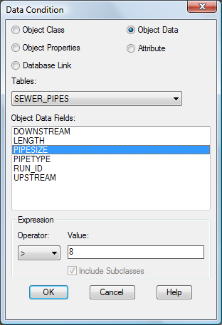
- In the Data Condition dialog box, do the following:
- Select Object Data.
- Under Tables, select SEWER_PIPES.
- Under Object Data Fields, select PIPESIZE.
- In the Expression area, under Operator, select >. Under Value, enter
8.

Specify sewer pipes that are more than 8 inches in diameter.
- Click OK.
- In the Define Query of Attached Drawing(s) dialog box, under Options, click Zoom Ext.
- In the Zoom Drawing Extents dialog box, click OK.
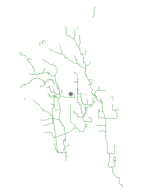
- In the Define Query of Attached Drawing(s) dialog box, under Query Mode, select Preview, and click Execute Query.

Only the sewer lines that are greater than 8 inches in diameter are displayed.
- To create an object data index to improve performance for object data queries, leave the drawing open.
To continue this tutorial, go to Exercise 6: Create an object data index (optional).