Set DWF publishing options that specify the attribute information to publish with your map.
Note: This exercise uses the
build_map1.dwg map you created and modified in the previous exercises.
To set publishing options
- Open your finished map from the previous lesson.
- Click

 OpenDrawing.
- Locate the build_map1.dwg file.
- Select it, and click Open.
- Click
- Click
.

- In the Map Information dialog box, select Publish Map Information.
- In the Map Information dialog box, expand the items in the list and select the Roads and Parcels items.
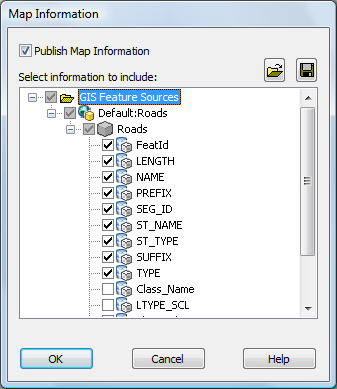
You can include and exclude information at any level.
Notice that when you select Roads, everything under Roads is automatically selected.
- To publish the information to an XML file, click the file icon at the upper-right in the dialog box (Save). Specify a location for the published file. Click Save.
The DWF Publish operation uses the XML file.
- Click OK in the Map Information dialog box.
To continue this tutorial, go to Exercise 2: Publish to DWF.