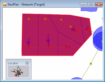
Subcatchments can be added by digitising polygons in the GeoPlan Window. To mark out a subcatchment, a polygon is drawn over the top of the map, enclosing one or more nodes. Each subcatchment should be defined in such a way that its borders correspond to those of the adjacent subcatchments.
Subcatchments can also be imported via the Open Data Import Centre.
If subcatchment data is imported from an external database, or the subcatchment is created on the Subcatchment Grid Window of the Subcatchments Grid, then the subcatchment probably does not have boundary information.
In order to edit a boundary on the GeoPlan Window, it is necessary first to create a boundary. Dummy boundaries can be created or alternatively, subcatchment boundaries can be created using the Thiessen Polygon method.
Creating Dummy Boundaries
To create dummy boundaries
- Choose Subcatchment
 Create dummy boundaries from the Model menu.
InfoWorks ICM will create circular boundaries for all subcatchments that do not have boundary information. The area of the circle represents the Total Area of the subcatchment as entered on the grid or property sheet.
The subcatchment boundary can now be edited in the same was as with any other subcatchment.
Creating Boundaries using Thiessen Polygons
Subcatchment boundaries can be generated and updated using the Thiessen Polygon method.
A bounding polygon is required within which subcatchment boundaries will be generated. Boundary creation can be limited by making a selection of nodes within the polygon. Existing subcatchment boundaries can be optionally replaced.
To create boundaries using Thiessen polygons
- Draw a bounding polygon for the operation. This polygon will probably follow some, or all, of the watershed of the catchment. Alternatively, import the bounding polygon via the Open Data Import Centre
- Select the polygon on the
GeoPlan Window
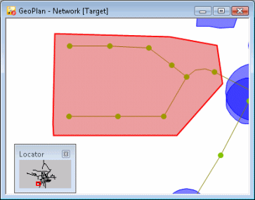
- To create subcatchment boundaries for just some of the nodes, select these nodes now. Make sure the polygon remains selected. Alternatively, set up a
selection list in advance. The selection list can be included later in the process.
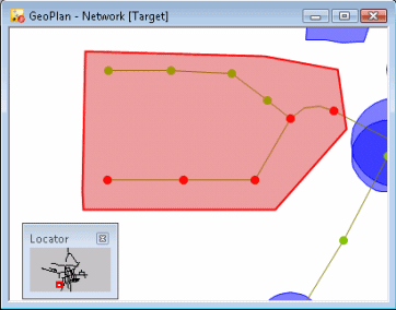
- Choose SubcatchmentCreate within selected polygon from the Model menu. This option is only available if the polygon is selected. This displays the
Create Thiessen Subcatchments Dialog.
- Choose the Type of subcatchment to be created. See System Type for more details.
- If required, include a Selection List, or click Current to include the current selection. This will limit the boundary creation just to the selected nodes. By default all nodes will be processed.
- Choose whether to Update Existing Subcatchments. Check this option to replace existing boundaries. If this option is left unchecked, any node with an existing subcatchment of the chosen type will be ignored
- Click OK to complete the process.
InfoWorks ICM will now create Thiessen polygons for all selected nodes (all nodes if no selection was included). New subcatchment boundaries are created for all selected nodes. Nodes with existing subcatchments are ignored if the Update Existing Subcatchments box was not checked.