Maximum flood contour information can be exported from one or more simulations to a selected MapInfo or ESRI file format. The formats currently supported are:
- MapInfo MIF format (MIF)
- MapInfo TAB format (TAB)
- ESRI Shape format (SHP)
- ESRI ASCII Grid format (ASC)
In order to export the maximum flood contour data, InfoWorks ICM requires you to specify one or more simulations, a ground model and a theme, which contain elevation and contour interval information, as well as the location of the folder where the files are to be exported to. The names of the exported files are automatically given the same names as the simulations with the appropriate file extensions. Any existing files in the 'export' folder, which have the same file name and extension as the ones currently being exported, will be automatically overwritten during the export operation.
To export maximum flood contours:
- Select the Export Maximum Flood Contours option from the
Results menu, and then select the type of file which you want to export the files to from the list. The appropriate
Export Maximum Flood Contours dialog is displayed.
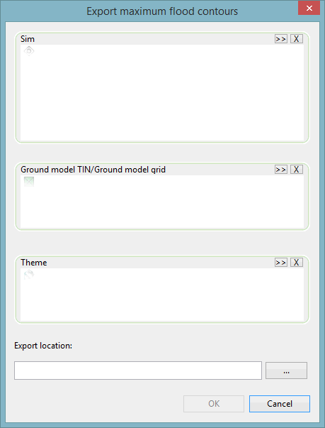
- Drag one or more simulations from the
Explorer window to the Sim drop target or use the
 button to browse for simulations.
If you have selected any cloud simulations whose results have not been downloaded, a message is displayed informing you of this and asks if you would like to download the results now.
- Select Yes if you want to export those results. The Download Cloud Results dialog is displayed.
- Select the type of results you want to download.
- Click Ok.
When downloaded, you can include the downloaded results in the Sim drop target in the Export Maximum Flood Contours dialog.
- Drag a
TIN or
grid ground model from the
Explorer window to the Ground model TIN/Ground model grid drop target or use the
button to browse for the appropriate ground model.
-
Drag a theme from the Explorer window to the Theme drop target or use the
button to browse for the required theme.
- Type in the location of the folder where the exported files are to be saved to or use the
 (Browse) button to search for it.
- Select OK and the following files will be exported to the specified folder:
Type File Extension MapInfo MIF MIF and MID
MapInfo TAB
DAT, ID, MAP, TAB
ESRI Shape DBF, SHP, SHX
ESRI ASCII Grid ASC
The data can then be imported into the appropriate GIS system.