Spatial Data refers to background GIS layers such as roads, railroads, hospitals, schools, water bodies, etc.
You can import spatial data layers for visibility and for use in LoF and CoF spatial analyses. For example, you may want to score pipes based on proximity to major highways or critical facilities.
You can import data via local GeoJSON files or Shapefiles, or via an integration with ArcGIS Online.
Important: Ensure your data are in the WGS84 / EPSG4326 coordinate system before you import. If using Shapefiles, the local coordinate system will be re-projected to the WGS84 system by
Info360 Asset.
Note: There are several reserved words that cannot be used as attributes: Yes, No, True, False, and On.
 Video: Import Spatial Data via GeoJSON or Shapefile
Video: Import Spatial Data from ArcGIS Online
To import spatial data:
- Go to Data
 Spatial Data.
- Click New Import.
- Complete the fields bearing in mind the following:
- Layer Name: This name will be displayed in other areas of Info360 Asset, such as Risk and Rehab.
- Data Source:
- GeoJSON: Import GeoJSON files of up to 500 MB.
- ArcGIS: An integration must be set up for this option. See Create Integration for ArcGIS Online Imports or Exports.
- Shapefile: You'll need a single .zip file containing .shp, .shx, .dbf, and .prj files.
- Import Configuration: If this is a new GIS layer, select New Configuration. If you are updating an existing GIS layer and have previously mapped the fields in your Source to the fields in Info360 Asset, you can choose the existing import configuration and as long as the schema is the same, the fields will be mapped automatically.
- If you are importing via a GeoJSON file or Shapefile:
- Drag and drop your file to start the upload.
If you are importing via an ArcGIS integration:- Click Select Layer.
- Select a feature service, then select a Layer.
- Map the fields you are interested in seeing in
Info360 Asset and/or using in CoF or LoF analysis that are based on Spatial Data attributes. In the table, click on a row and select a Target Field.
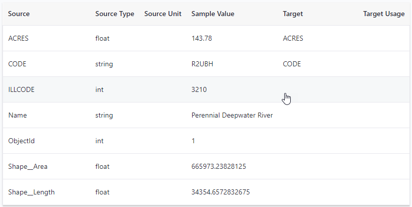
You can set the Source Unit by first selecting a Target Usage. Make sure to do this for date-time fields so that these are stored as dates.
- Once the mapping is complete, click Import.
- Enter a Configuration Name. This mapping configuration will be saved for future GIS updates and will be available under the Import Configuration option.
- After the spatial data is imported, the GIS layer will be available on the network map.