Australian Rainfall and Runoff 19 (ARR19) is a national guideline document for the estimation of design flood characteristics in Australia. It is published by Engineers Australia. The coefficients entered will describe the rainfall for a particular area of the country.
Supply the ARR Data Hub file and BOM design rainfall file and the select the required set of AEP and Storm Durations to be run by the analysis.
Parameters
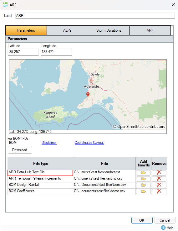
By specifying the Longitude and Latitude, as well as supplying the ARR Data Hub file and the BOM Design Rainfall file, depths can be calculated for different locations in Australia.
The download button will automatically download and use the ARR Data Hub, ARR Temporal Patterns Increments, BOM Design Rainfall, and BOM Coefficients files from the ARR website.

Latitude, Longitude
Location's position as decimal values. This can be manually entered or selected by clicking the map.
BOM IFDs
Gives links to the Disclaimer and Coordinates Caveat.
Download
Automatically obtains the data (ARR Data Hub, ARR Temporal Patterns Increments, BOM Design Rainfall, and BOM Coefficients) from the ARR website. This will prompt save dialogs to save the data locally. Data files will be updated to show the files have been downloaded.
Data Files
The files for ARR Data Hub, ARR Temporal Patterns Increments, BOM Design Rainfall, and BOM Coefficients can be added or removed manually here. The file location where they are stored locally is also displayed.
BOM Coefficients are used in the Network Design and Modified Rational Method analysis to calculate the correct rainfall depth, the calculation is as follows:

AEPs
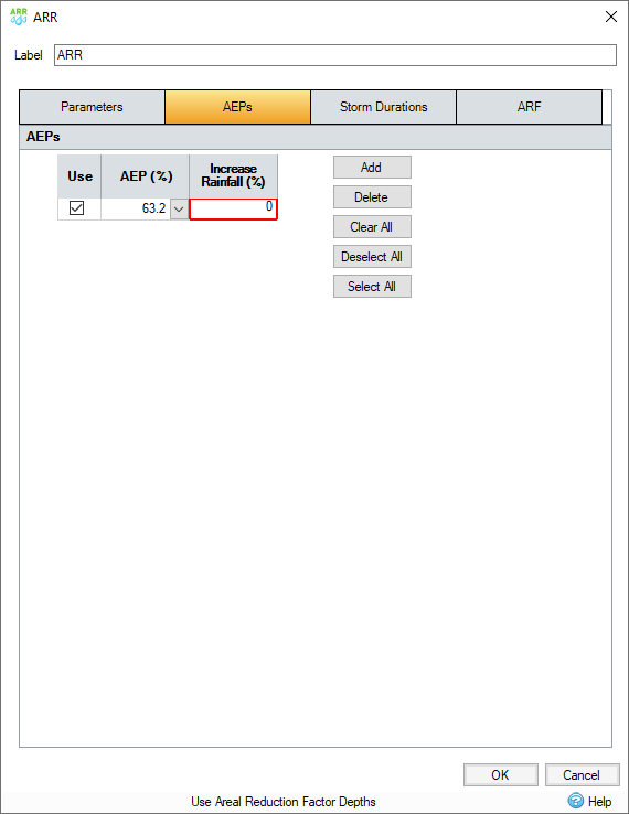
The AEP options in the set [63.2, 50, 20, 10, 5, 2 and 1] are dimensionless probabilities. These will be taken from the BOM’s IFD Data table. Although the Increments file listsAEP AEPs according to ‘Frequent’, ‘Intermediate’ and ‘Rare’, the way to match these up is listed below.
The 50% AEP IFD does not correspond to the two-year Average Recurrence Interval (ARI) IFD. Rather it corresponds to the 1.44 ARI.
The 20% AEP IFD does not correspond to the five-year Average Recurrence Interval (ARI) IFD. Rather it corresponds to the 4.48 ARI.
In the ARR Data Hub the following image shows the Temporal Pattern set used for the given AEP for analysis, (see ARR Guidebook Book 2 Chapter 5 for guidance).


Storm Durations
A set of Storm Durations and run times must be specified for the analysis to run back to back. Temporal Patterns for these storm durations are extracted from the ARR Data Hub

ARF
Specify Areal Reductions Factor details (see ARR website).

Use Areal Reduction Factor
By checking this on you ensure that the Areal reduction factor coefficients are being used, the other controls will be disabled until this is checked.
Input Type
Use plan data or specify user input. During analysis, if using Plan Data option then total area for the phase will be calculated and used in the ARF equation.
Total Catchment Area
If the user input option is set, then the total catchment area for the ARR data is set here.
Use Area Reduction Factor Depths
Check this option to use the long duration areal reduction factor coefficients. During analysis if this option is ticked the calculated ARF (see ARR Guidebook Book 2 Chapter 4 for guidance) will be applied to the Rainfall Depth at the given AEP and Storm Duration.
Long Duration Areal Reduction Factor Coefficients
Long duration ARF coefficients a, b, c, d, e, f, g, h, i are listed here.
Use Areal Reduction Factor Patterns
Check this option to use areal reduction factor patterns obtained from file. If selected and a valid ARF Pattern is loaded only the following storm durations are available for analysis: 720, 1080, 1440, 2160, 2880, 4320, 5760, 7200, 8640, 10080.
ARR Areal Temporal Patterns Increments File
Set the ARF patterns from this file by selecting the Add from file option. Click Remove to clear the ARF Patterns file data.