To recreate an InfraWorks model with a different coordinate system
Export data from your current model and use it to re-create the model with a different coordinate system
If you created an InfraWorks model but assigned the wrong coordinate system during model creation, you may need to re-create the model and assign a different coordinate system. This typically occurs if you want to exchange data between your InfraWorks model and other Autodesk applications such as Autodesk Civil 3D or Autodesk Revit.
In the existing model, click Share Export IMX (F8).
Checkmark Use Entire Model in the Export to IMX dialog.
Click Export.
Return to InfraWorks Home
Click New.

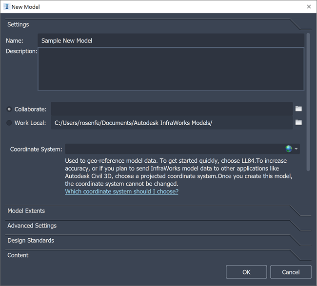
Click Settings.
Specify a name that will be assigned to the model database file and data folder. You can also choose a description.
Specify how the new model will be stored. You can choose Collaborate or Work Local:
Model Storage Options
Collaborate
Click
 to choose an Autodesk Docs Document Management project folder.
 - The new model will be uploaded to the cloud and stored in the Autodesk Docs project folder of your choosing.
- Using Autodesk Docs allows you to collaborate with anyone who has access rights to the specified project folder.
- You must select a Autodesk Docs project folder to host the cloud model before you can create it.
Notes: If there are no available Autodesk Docs project folders displayed, verify that you have created an Autodesk Docs account, are signed-in, and have been granted permissions to an Autodesk Docs Document Management project by a project administrator.
Work Local
Click
 and browse to a location on your local system, or accept the default storage location for local models. By default, the model database and associated data folders will be stored on your C:/ drive. Click
  to specify a different location to store the new model locally.
Notes: Cloud models and generated surface tiles are cached in different locations for local and cloud models. You can update default cache locations using Application Options.
Important: Storing local models in a folder that is synced with the Desktop Connector is not supported.Click
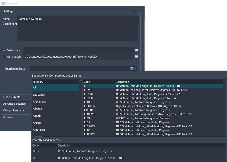
 to specify a coordinate system from the model, using the search bar, the extended list of categories and codes, or select a recent coordinate system from the drop-down list. This cannot be undone once the model is created.
 Tip: If you're going to exchange data between this InfraWorks model and other Autodesk applications such as Autodesk Civil 3D or Autodesk Revit, choose a projected coordinate system (such as a state plane or UTM coordinate system) for this InfraWorks model.
Optionally, click Model Extents.
- Define Model Extent: Specifies a smaller area when dealing with large model data extents.
- Minimum X: Lower left corner of the model extents.
- Minimum Y: Lower right corner of the model extents.
- Maximum X: Upper left corner of the model extents.
- Maximum Y: Upper right corner of the model extents.
- Load Extents From File: A file that specifies the extent coordinates.
Optionally, click Advanced Settings to define a schema template file or modify the model's display coordinates.
Important: As a best practice, do not specify any advanced settings unless you have a specific customization in mind.- Schema Template File — A schema template file to use with your model.
- Schema templates allow you to set up custom classes, attributes, and categories when a model is first created
- Display Coordinates — The display coordinates, also known as the User Coordinate System (UCS), determines the coordinates displayed in the status bar. It does not affect how model data is stored or displayed
Click Design Standards.
Select the road standard to apply to design roads and specify driving direction.
Optionally, click Content to load your own content libraries.
Click OK.
Once the new model opens, you can import data.
To re-create the previous InfraWorks model, import the IMX file you exported in Step 3.