To import 2D raster terrain overlays
Import raster images as 2D overlays that are draped to the terrain. After configuring and placing a 2D overlay in your model, you can position the overlay more precisely in-canvas using reference points.
Video Playlist: Terrain Overlays
Click Manage
 Content
  .
.Click
 (Add File Data Source) in the Data Sources panel and click Raster.Note: Raster image formats such as PNG or JPG are recommended. See Supported File Formats Reference.
Double-click the imported data source in the Data Sources panel to open the Data Source Configuration dialog.
Choose Terrain Overlays as the Type if it is not already specified.
Navigate to the Raster tab and specify desired settings. See To configure raster ground imagery data for more information.
Click the Geo Location tab.
Click Interactive Placing.
Note: Terrain overlays do not support world files. While not recommended as a best practice, you can manually enter latitude and longitude coordinates in the Position panel within the Data Source Configuration dialog. See To specify geolocation settings for more information.Click Close & Refresh. Your 2D overlay will be draped to the terrain.
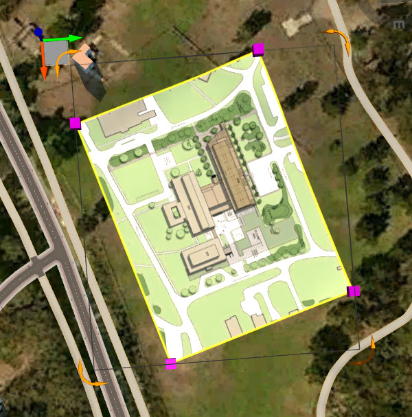
You can rotate, re-size, or move Terrain Overlays in Edit Mode using the grips and gizmos.
To position an overlay more precisely, place by Reference Points. See To position 2D Overlays using Reference Points.