Create a new model from InfraWorks 360 Home.
- On InfraWorks 360 Home, which displays when you start the programme, click New.
- Click Settings and specify a name that will be assigned to the model database file and data folder. You can also choose a description.
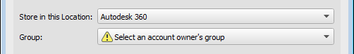
- Specify how the new model will be stored.
- By default, new models are stored in the Autodesk 360 cloud and are associated with a design group of your choosing. You must select a design group for a cloud model before you can create it. This allows for your cloud model to be shared in design groups, or through the web browser.
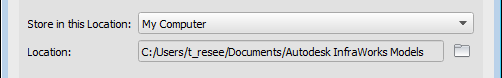
- Choose My Computer to create a local model. The model database and associated data folders will be stored in the default filepath location on your C:/ drive. Click
 to specify a different location to store the new model locally.
Note: Cloud models and generated surface tiles are cached in different locations. Specify cache locations using Application Options. - By default, new models are stored in the Autodesk 360 cloud and are associated with a design group of your choosing. You must select a design group for a cloud model before you can create it. This allows for your cloud model to be shared in design groups, or through the web browser.
- Click Model Extents.
- Define Model Extent — Specifies a smaller area when dealing with large model data extents.
- Minimum X — Lower left corner of the model extents.
- Minimum Y — Lower right corner of the model extents.
- Maximum X — Upper left corner of the model extents.
- Maximum Y — Upper right corner of the model extents.
- Load Extents From File — A file that specifies the extent co-ordinates.
- If necessary, click Advanced Settings. Generally, it's better to leave these set to their default values.
- Schema Template File — A schema template file to use with your model.
Schema templates allow you to set up custom classes, attributes and categories when a model is first created.
- Co-ordinate System — The co-ordinate systems for the User Co-ordinate System (UCS) and database co-ordinate system.
The UCS co-ordinate system determines the co-ordinates displayed in the status bar. It doesn't affect how model data is stored or displayed.
The database co-ordinate system affects the model data stored in the .sqlite file. This can affect how the data appears when the .sqlite file is opened in a different application, such as AutoCAD Map 3D.
Click
 and choose the co-ordinate system from the extended list of categories and codes, or select a recent co-ordinate system from the drop-down list.
- Schema Template File — A schema template file to use with your model.
- Click Design Standards.
Select the road standard to apply to design roads and specify driving direction.
- Click OK.
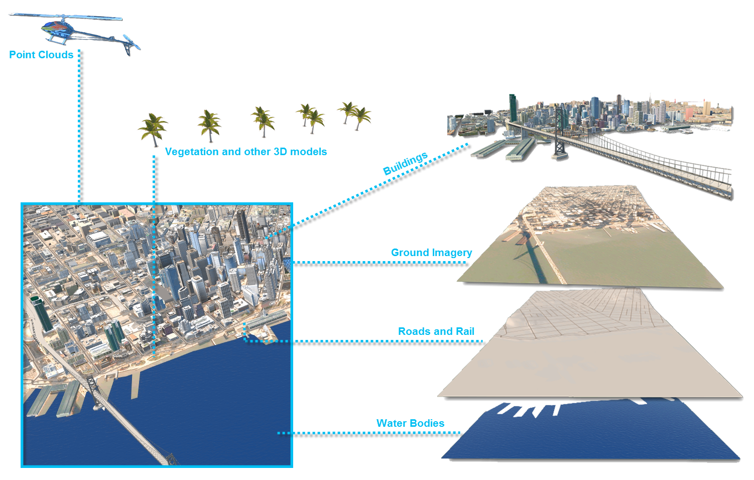
- Import data.
Advanced Tips
- For a local model, you can make a copy of it before opening it. This copy preserves the original model so it can be opened in preceding versions.
- For cloud models, you can choose to upgrade a copy of the model if you want to leave the original model in the preceding version for the rest of the team.