Utility Design distinguishes between base map data used for reference and design data that you create and work with in your design. Design data is part of the industry model and contains attribute information in addition to its geometry.
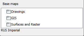
You can add base map information to your map by attaching xrefs or using the Map 3D Data Connect tool to connect to data from a variety of sources. The base map sources you use in your design are shown in the Base Maps section at the bottom of the Design Explorer.
If you have a Civil surface in your drawing or in an attached drawing, Utility Design can determine the elevation and position your design features correctly on the surface. When you add new lines, devices, and guys, Utility Design sets the elevation automatically.
For more information about using Data Connect, see Bringing In Data in the AutoCAD Map 3D Help. For more information about attaching xrefs, see the AutoCAD Help.