Metadata is data about data. Geospatial metadata describes your GIS data according to an established standard to help others who use your maps to understand them. Organizing your data according to standards helps you manage it more efficiently, enforces data quality, and facilitates data sharing. In AutoCAD Map 3D toolset, you can automatically generate metadata for DWGs; their resources, such as object or feature classes; and non-DWG files.
AutoCAD Map 3D toolset currently supports two standards for geospatial metadata: the FGDC CSDGM Standard and ISO 19139.

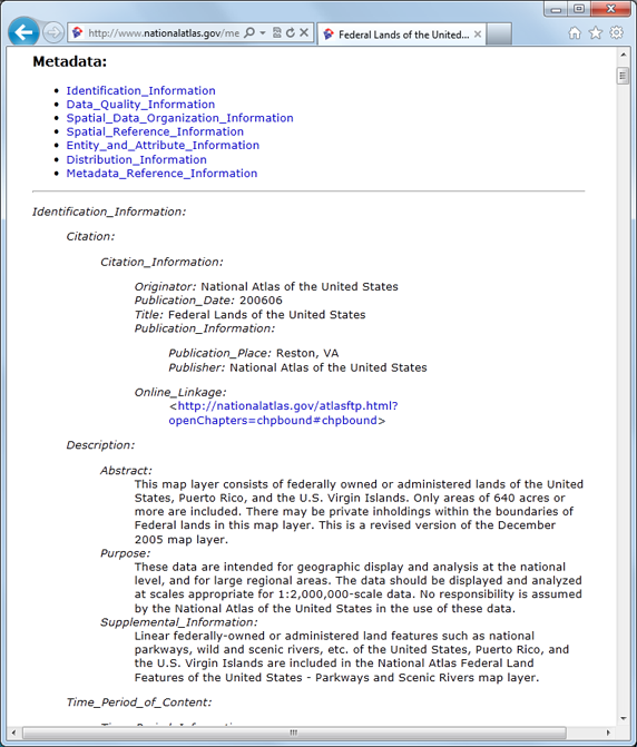
Example page of metadata in FGDC format.
The FGDC Standard (United States)
In 1998, the Federal Geographic Data Committee (FGDC) released the Content Standard for Digital Geospatial Metadata (the FGDC CSDGM Standard ). Its goal is to promote electronic, geospatial information-sharing between various agencies and regions around the world. Some agencies in the United States may be required to create geospatial metadata that complies with this standard.
- Mandatory
- Optional
- Conditional
The FGDC standard specifies seven major sections of GIS metadata. Each section has several data elements, and compound elements. Each element must meet one of the following conditions:
Conditional elements are “mandatory if applicable.” For example, if a particular data set does not have or need distribution information as defined by the FGDC, you need not complete any of the fields in the Distribution Information section, even if some fields in that section are mandatory.
| Information Type | Description | Requirement | Related Editor |
|---|---|---|---|
| Identification Information | Basic information about the data | Mandatory | The Contact Information Editor (FGDC Metadata) |
| Data Quality Information | Overall quality of the data | Conditional | The Citation Information Editor (FGDC Metadata) |
| Spatial Data Organization Information | How spatial information is represented in the data | Conditional | The Spatial Data Organization Information Editor (FGDC Metadata) |
| Spatial Reference Information | Details about the spatial reference of the data, such as coordinates | Conditional | The Horizontal Coordinate System Definition Editor (FGDC Metadata) |
| Entity and Attribute Information | The features and constraints of the data | Conditional | The Attribute Domain Values Editor (FGDC Metadata) |
| Distribution Information | Who provides the data, and how it can be obtained | Conditional | The Standard Order Process Editor (FGDC Metadata) |
| Metadata Reference Information | How current the metadata is, and who maintains it | Mandatory | The Time Period Information Editor (FGDC Metadata) |
Because GIS data is so general, it remains usable outside the United States when formatted with this standard. For example, the FGDC standard shares many common fields with ISO 19139. To learn more about the FGDC and its GIS metadata standard, visit http://www.fgdc.gov/metadata.
ISO 19139
AutoCAD Map 3D toolset supports ISO 19139. If your version of AutoCAD Map 3D toolset is for any country except the United States, it is configured with ISO as the default. If you need to switch to a different standard, you can do so in the Metadata Options dialog box.