Revit provides several ways to define context for the model.
If you are new to the positioning features of Revit, use the following links to learn about important concepts.
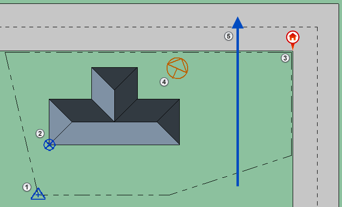
 The
survey point orients the building geometry in a survey
coordinate system.
The
survey point orients the building geometry in a survey
coordinate system.
You can use the survey point to establish a shared coordinate system, useful when linking multiple models.
 The
project base point establishes a reference for measuring distances and positioning objects in relation to the model.
The
project base point establishes a reference for measuring distances and positioning objects in relation to the model.
 The
geographic location specifies the model's real-world location using global coordinates.
The
geographic location specifies the model's real-world location using global coordinates.
 True North sets the real-world north direction based on site conditions.
 Project North orients the predominant axis of the building geometry with the top of the drawing area for easy design and placement on sheets.
To learn about the important tasks required to position your model, read this topic: