Select an area of interest in the Model Builder to build a high quality model of that location.
- Open Model Builder.
From InfraWorks 360 Home, click
 to expand a horizontal menu and click Model Builder.
- In the Search by Location field, enter a location name, address, or point of interest.
You can also input longitudinal and latitudinal co-ordinates. For example, 38, -122.
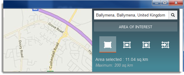
- Use the compass and zoom in/out tools to further refine your search.
- Adjust the map view style as desired:
- Click Road
 Road for a standard map view.
 - Click Road Automatic to optimise the map view as you zoom in and out.
- Click Road Bird's Eye for a better angle for aerial imagery.
Note: The Model Builder view style is a visual aid for navigation purposes only and has no effect on the models that are generated by Model Builder. For example, if you select an area of interest while in Road view style, the resulting model includes aerial imagery even though the Road view style doesn't. - Click Road
- Select the area of interest using any of the following methods:
- Click
 to select the current map extents.
 - Click
 to draw a rectangular area of interest on the map.
 - Click
 to draw a polygonal area of interest on the map.
 - Click
 to import a polygonal area of interest from a SHP file.
To modify an area of interest, click the boundary box to display grips. Drag each grip to the desired position.
Note: The Model Builder supports areas up to 200 square kilometres. - Click