The effect of a rainfall event can be viewed for a particular run of pipes or a specific node by replaying the simulation in the Long Section view.
To illustrate how to view results in the Long Section view, we will use the 'Obs4p' simulation (not the rainfall event of the same name) within the 'Langley Observed 4' Run Group.
- If the simulation is not open, drag the object onto the main window.
Click the '
 Obs4p' simulation icon in the Run Group in the
Explorer window and drag it onto the main window.
Obs4p' simulation icon in the Run Group in the
Explorer window and drag it onto the main window.
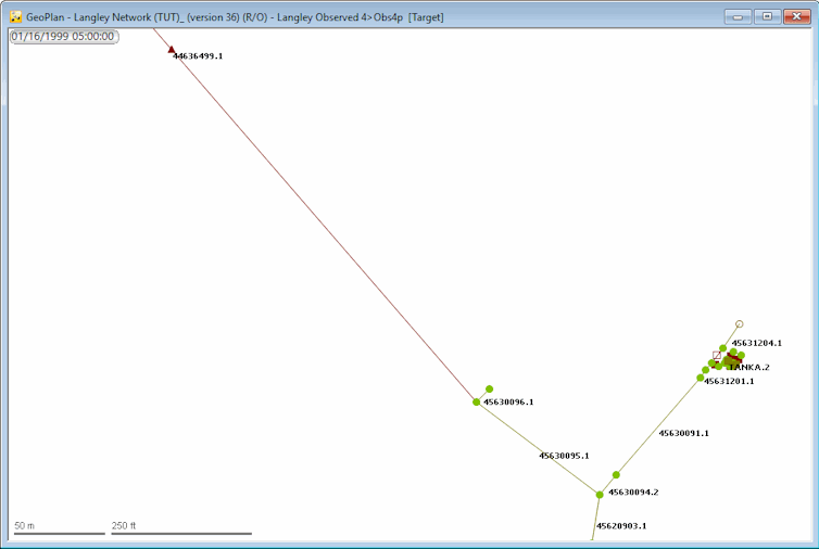
The network is opened in the GeoPlan.
-
Close the Locator window (so that it does not obstruct the view).
- Use the GeoPlan tools
 (Zoom in) and
 (Pan) buttons on the
toolbar to zoom into and display the part of the network containing the pump (link '44636499.1', represented by a brown triangle) and outfall (node '45631203', represented by a circle). Alternatively, search for the node or link using the
(Pan) buttons on the
toolbar to zoom into and display the part of the network containing the pump (link '44636499.1', represented by a brown triangle) and outfall (node '45631203', represented by a circle). Alternatively, search for the node or link using the
 (Find in GeoPlan) toolbar tool.
- Locate node '45630095' on the North East side of the network (to the south of the pump) and select all the pipes leading to the outfall ('45631203') node. You can use the selection tool (
 ) while holding the Ctrl key to select multiple objects.
- Once selected, click the
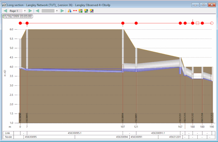
 (Long section) tool to display the selected area in the Long Section view.
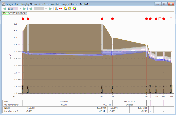
You can now set up some labels on the Long Section view. This is a valuable feature that can help you visualise the variations of some parameters of interest as the simulation is run. To do so:
- Right-click the Long Section view and select Properties from the pop-up menu.
The Section Properties dialog is displayed.
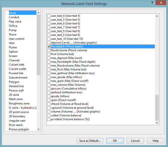
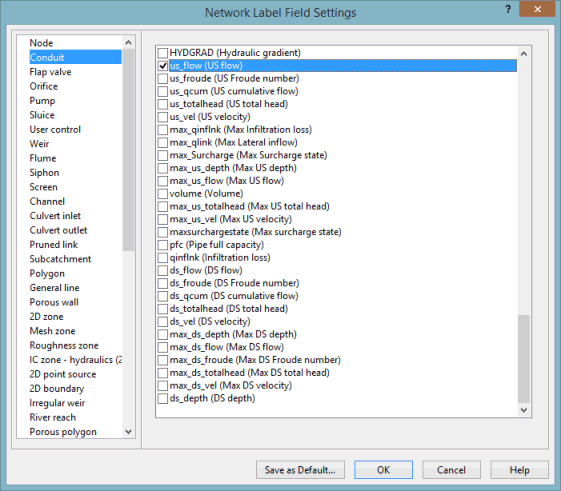
- In the Content tab, click the Field Settings button. The Network Label Field Settings dialog is displayed.
- For this example, select the following parameters from this dialog:
- flooddepth (Do not select flood_depth_1 or flood_depth_2) for Node
- us_flow for Conduit
- flooddepth (Do not select flood_depth_1 or flood_depth_2) for Node
- Click OK in both the dialogs to close the windows.
- Click the
 button to play the simulation. As the replay progresses you will be able to see the water level changing in the Long Section view. You can run the simulation and pause it at a specific time to observe values at that particular time.
- Close the Long Section view
Click the
 button in the top right-hand corner of the window , and clear the selection on the GeoPlan
Click the
button in the top right-hand corner of the window , and clear the selection on the GeoPlan
Click the
 button in the
Selection toolbar .
button in the
Selection toolbar .
If you zoom in on the block of symbols near the outfall, you will see that it consists of a group of nodes, weirs and an orifice.
The labels are now shown in the boxes at the bottom of the Long Section view:

 Back to flowchart