You can use the Import Shape Survey Data command to import survey data from ESRI® shapefiles into an Autodesk Civil 3D drawing.
Survey data can be transferred from other software into Autodesk Civil 3D through shapefiles (SHP files). The SHP files typically contain only one type of geometric data: lines or points. Curved linework is not supported.
Unlike survey databases, when you transfer the information to Autodesk Civil 3D using SHP files, the survey information is contained within Autodesk Civil 3D drawings and is not linked to the survey database. To share survey data between drawings, the linework and points must be copied between drawings or reimported into other drawings.
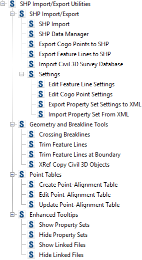
Workflow Tools
Use the Toolbox tab in Toolspace to access the SHP Import/Export commands.
Settings Files for Managing Feature Line and Point Settings
You can create feature line and point settings files for managing the re-use of a list of settings with the same or a different drawing. You can also export and then import settings files for use with other drawings.
Feature Line Settings
In most cases, you will want to create feature line or point settings to modify, control, and query (filter) the import and display of survey data for a specified SHP file.
- layer
- site
- type of linework to import (feature line, 2D polyline, or 3D polyline)
- style
Property set data may also be assigned to the survey data based on the feature line setting.
Point Settings
- layer
- point name
- raw desc (raw description)
- point style
- point label style
Property set data may also be assigned to the survey data based on the point setting.
SHP Data Manager
You can use the SHP Data Manager command to locate specific lines and points within the drawing.
Queries
You can build queries to filter or restrict the feature line or point data to be imported or displayed.
When feature lines or points are imported or created, they are matched with the specified shape file and queries in the feature line or point setting.