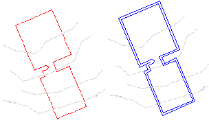
Creates a new feature line or polyline from an offset and difference in elevation from a selected feature line, survey figure, parcel segment, or polyline (2D or 3D) polyline.
Specify the offset distance, the side, and elevational difference, or absolute elevation.
- Click
 Find.
Find.
- Select an object to offset.
Note: The selected object must be one of the following types: Feature Line, Parcel Segment, Survey Figure, or Polyline (2D or 3D).
- Do one of the following to specify the location for the offset:
- Specify the offset distance, then select the object to offset.
- Enter Through, then select the object to offset and select a through point. The offset will be drawn through this point.
- Do one of the following:
- Specify a point on the side where you want to place the offset. Then specify the elevational difference or the absolute elevation for the offset.
- Enter
Multiple and specify the side and elevational difference for each offset.
If you enter Variable, it will display a marker at the first point on the offset feature line. You can specify the elevation difference from the original point or the absolute elevation. After you enter a value, it will move to the next point and prompt for its elevation. It will continue to do this for each point on the feature line until you end the command.
Note: The generated offset object is dependent on the referenced source object:- Feature Lines and Survey Figures create offset feature lines.
- Polylines and Parcel Segments create offset polylines.
- Select another object to offset, or press Enter to end the command.