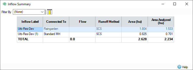
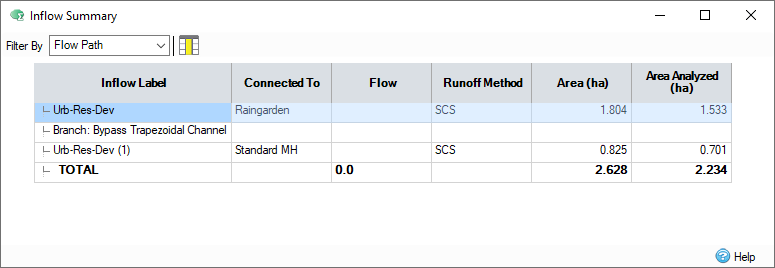
The Inflow Summary form displays the information about the inflows within a phase or flow path, including the total area of catchment areas, and the total flow of base flows.
Phase
When the Filter By drop-down menu is set to (None), the inflow summary displays phase wide information. All catchment areas and base flows within the phase are displayed, and included in the total value.

Inflow Label - The name of the inflow.
Connected To - The label of the junction, manhole or stormwater control that the inflow is connected to.
Flow - Specific to base flows and input hydrographs. For base flows, the constant rate of flow into the phase / path. For input hydrographs, the cell shows "VARIES ", this is shown in the total row if any hydrographs are present in the phase / path.
Runoff Method - Specific to catchment areas, the runoff method associated with the dynamic sizing of the inflow.
Area - Specific to catchment areas, the area of the inflow.
Area Analyzed - Specific to catchment areas, the area of the inflow to be used for analysis, calculated as total area multiplied by percentage impervious.
Flow Path
When a flow path is selected in the Filter By drop-down menu, the inflow summary displays only the catchment areas and base flows which are connected to items within the flow path (main line and branch lines).

The inflow summary shows the same information when displaying a flow path, but also includes collapsible rows for each branch line within the flow path.
A catchment area or base flow is included in every flow path it exists in. This will cause the sum of the total for each flow path to be greater than the phase wide total.
Urban Creep
Clicking the
Show Urban Creep Effect  button displays additional information in the
Inflow Summary form, including Urban Creep, Percentage Impervious, and Adjusted Percentage Impervious.

Inflow Label - The name of the inflow.
Connected To - The label of the junction, manhole or stormwater control that the inflow is connected to.
Flow - Specific to base flows and input hydrographs. For base flows, the constant rate of flow into the phase / path. For input hydrographs, the cell shows "VARIES ", this is shown in the total row if any hydrographs are present in the phase / path.
Runoff Method - Specific to catchment areas, the runoff method associated with the dynamic sizing of the inflow.
Area - Specific to catchment areas, the area of the inflow.
Percentage Impervious - Specific to catchment areas, the percentage impervious associated with the dynamic sizing of the inflow. If a runoff method without a dynamic sizing percentage impervious is used, this cell will be blank.
Urban Creep - Specific to catchment areas, the scale to which you increase the area to be used for analysis. Either a global or per catchment value, dependant on Analysis Criteria. For more information on urban creep, refer to Analysis Criteria.
Adjusted Percentage Impervious - Specific to catchment areas, the area, multiplied by the percentage impervious. If a runoff method without a dynamic sizing percentage impervious is used, this cell will be blank.
Area Analyzed - Specific to catchment areas, the area of the inflow to be used for analysis.