Import polygons as land areas in your model and proposals. Similar to coverage areas, land areas are used to identify areas for development. Land areas can also be used to add grading styles to a specified area. Grading styles allow you to specify cut slope, cut material, fill slope and fill material values.
Note: View the Land Areas and Grading (preview) Video Playlist for more information.
- Follow the general import instructions.
Land area polygons can be brought into InfraWorks 360 from Autodesk AutoCAD Civil 3D DWG, IMX, CityGML, LandXML, SDF, SHP, or SQlite files. You can also bring in land area polygons through a FDO database connection.
- Double-click the new data source in the Data Sources panel.
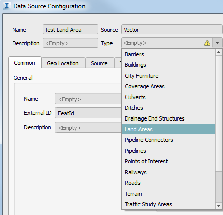
- Select Land Area as the Type in the Data Source Configuration dialogue box.
- Specify a Rule Style and Rule Grading if desired. This allows you to apply material, colour and grading styles to imported land areas using expressions, or by selecting styles from the Land Areas and Grading style catalogues. See To specify a Rule Style for more information.
- Select the Geo Location tab and specify desired settings. If your data doesn't have any co-ordinate system information associated with it, you'll need specify Arbitrary XY as the co-ordinate system and place the data yourself. See To specify geolocation settings for more information.
- Select the Source tab and choose Draping Options.
- Drape will conform the land area to the terrain, ignoring any of the polygon's Z values.
- Don't Drape will create the land area with Z values based on vertexes of the polygon(s) you imported.
- Set Level to a desired value or data source property and the land area will flatten the terrain to whichever level you specify.
See To specify draping options for more information.
Add a source filter if you would like. See To filter data during import for more information.
- Select Close & Refresh.