
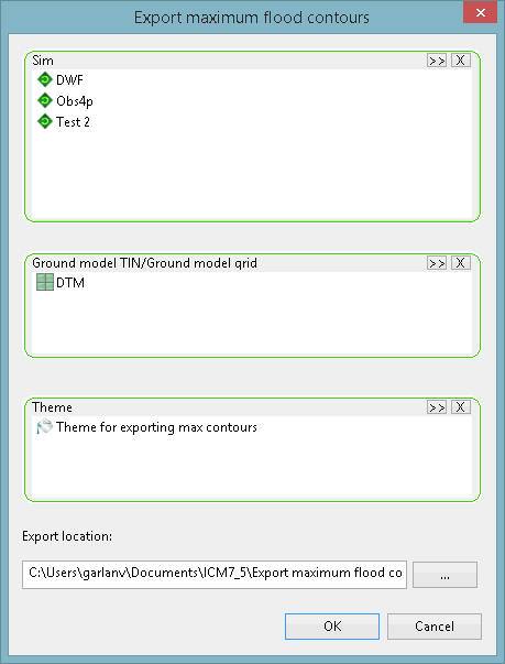
This dialog is used to
export maximum depth contours from one or more simulations to a selected MapInfo or ESRI file format. It is displayed when an export option is selected from the  Export maximum flood contours submenu.
| Option | Description | ||||||||||
|---|---|---|---|---|---|---|---|---|---|---|---|
| Sim |
A droptarget for one or more simulations that contains the results to be exported. You can: If you have selected any cloud simulations whose results have not been downloaded, a message is displayed informing you of this and asks if you would like to download the results now. If you select Yes, the Download Cloud Results dialog is displayed, enabling you to choose which type of results you want to download. When downloaded, the results can be added to the Sim box. |
||||||||||
| Ground model TIN/Ground model grid |
A droptarget for a TIN or grid ground model, which provides elevation information. Note: Only a Gridded Ground Model can be used when exporting maximum flood contours using the ESRI ASCII grid files option.
|
||||||||||
| Theme |
A droptarget for a theme that contains contour interval information. |
||||||||||
| Export location | The folder where the exported files will be saved. This can be type-in or chosen using the
 (Browse) button. (Browse) button.
|
||||||||||
| OK |
Exports the maximum flood contours. The names of the exported files will be the same as the name(s) of the simulation(s) with the following file extensions:
Note: Existing files in the specified Export location folder, which have the same file names and extensions as the ones currently being exported, will be automatically overwritten during the export operation.
|
||||||||||
| Cancel | Cancels the export operation and closes the window. |