
The Map view displays a geographical representation of zones or a network and can be displayed over the top of additional GIS map layers.
Some of the map view functionality is provided by a third party GIS object. IWLive Pro Operator Client currently supports MapXtreme from PBBI and ArcObjects / ArcEngine from ESRI. These allow background maps and additional layers to be displayed in MapXtreme or ESRI format.
See the map control topic for further information.
Map view settings
Map view settings are controlled by options available on the Tools menu:
- Tools | Options displays the Options dialog.
The GeoPlan page of the Options dialog allows users to manage map display options, such as map control selection, automatic loading of previously opened layers, and enabling of auto-panning.
- Tools | Properties displays the
Properties dialog.
In this dialog, users can edit network object display settings (including colour, symbol ,and line width), therefore controlling how the objects appear on the Map view.
Headlines page map view
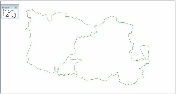
The Headlines page map view displays an overview map of all saved and enabled baselines.
The map displays a polygon for each baseline generated from the network extents. Each polygon is coloured depending on whether or not the associated baseline is enabled:
- Enabled baseline polygons have a black outline with a white fill
- Disabled baseline polygons have a grey outline and grey fill
Tip: Clicking a polygon using the
 (Open associated item) tool displays the Baseline view for the baseline associated with the polygon. If more than one baseline is associated with the polygon, a multiple selection dialog is displayed, letting you choose the baseline you require.
Zones page map view
The Zones page map view displays all the zones that have been defined for the currently selected baseline.
Tip: Clicking a zone in the map view displays the Baseline page with a map view zoomed into the polygon that has been defined as the zone.
Baseline page map view
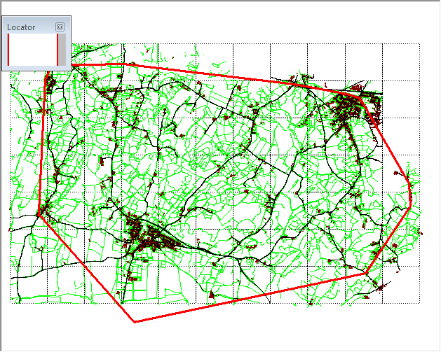
The Baseline page map view displays a detailed map of the network belonging to an individual baseline. All network objects are displayed in the map view.
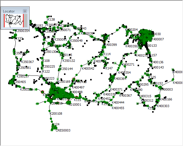
Tip: Clicking an object in the map view selects the object. You can hold down the Ctrl key to select multiple objects.
Map view locator window
The locator window (displayed in the top left of the map view by default), shows a simple schematic of the entire network, with a highlighted box displaying the current location of the map view in relation to the network as a whole.
Tips:
- Dragging the highlighted box within the locator window pans the map view to the location.
- The locator window can be resized and repositioned within the map view.
- You can show or hide the locator window using an option on the context menu, or by checking or unchecking an option on the GeoPlan page of the Options dialog.
Map view context menu
| Menu item |
Description |
|---|---|
| Zoom in | Zooms in by a fixed amount (50%) centred on the location clicked. |
| Zoom out | Zooms out by a fixed amount(200%) centred on the location clicked. |
| Centre | Centres the view at the point clicked. |
| Previous view | Goes back to the previous view displayed before carrying out one of the map view zoom or pan operations. |
| Find selection | Zooms the view in or out to show all selected objects within the window. If no objects are selected the command has no effect. |
| Find network |
Zooms the view in or out to show the entire network within the window. |
|
Show locator window |
Turns on and off the Map view locator window. |
|
Clear all labels |
Removes all labels from the current Map view. |
|
Layer control |
Displays the GIS Layer Control dialog, allowing users to display additional GIS layers on the Map view. |
|
View entire layer |
Zooms the view in or out to show the entire chosen layer within the window. Opens a dialog listing the available layers. |
|
Compare with |
This option is valid only for IWLive Pro Operator. Compares the currently selected run in the Map view with another run. Opens the Compare Run dialog, allowing users to select a run to compare the current run with. The Comparison page will be displayed. |
|
View online |
Allows Map view geolocation using common online maps. Invoking this option allows users to select a web mapping service. Supported types are:
The selected web map software will open in the default web browser, with the GPS coordinates that have been clicked on the Map view highlighted on the map. |
| View zone |
Applicable only to the Map view on the Baseline page. Lists the available zones in the baseline. Clicking a zone in the list zooms the view to that zone. |