Geographic location (geolocation) defines where the model resides in the real world. It enables location-based Forma workflows.
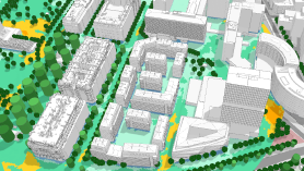
Why geolocation matters
Geolocation supports Forma workflows, including the following:
- Ordering contextual data — Displays contextual data available for the specified geolocation.
- Environmental analysis — Reflects local weather patterns and regional variables.
- Coordination — Shows models relative to one another for planning and design.
Types of geolocation
When you create a Revit model, it has no geolocation to indicate its real-world position.
To use the model with Forma workflows, you can specify its geolocation before connecting the model to a scenario, or during that process. You can use one of two methods:
- Draft geolocation is defined during the process of
connecting to a scenario. It uses a street address or latitude/longitude coordinates to establish a global context. The system creates a low distortion coordinate reference system (CRS) localized to the project area.
Use draft geolocation for early stage design when detailed survey data is not available.
When you specify a draft geolocation, the survey point is assigned the latitude, longitude, and elevation. That latitude and longitude define the origin of the local CRS created for the model.
- Advanced geolocation provides a complete geolocation using survey-based coordinate data. It may include projected coordinate systems, northing/easting coordinates, a localized project boundary, and optional fit points. Advanced geolocation is defined before connecting to a scenario, or afterwards to replace draft geolocation.
Use advanced geolocation when detailed survey data is available from civil engineers. With advanced geolocation, the survey point is assigned values based on the acquired coordinate system.
Before connecting to a scenario, check whether geolocation information is already defined for the model.
Related positioning methods in Revit
When a Revit model is connected to a scenario, the model's geolocation relates to other Revit positioning methods as follows:
- Survey point indicates the project's location on the earth. It is assigned coordinate values when draft or advanced geolocation is defined.
- Project base point continues to provide a local reference for measuring and positioning elements.
- Internal origin is unaffected by the geolocation.
- Location is used for Revit sun/shadow studies and energy analysis. When the model's geolocation is specified, the Location dialog updates to display the information.
- Shared coordinates relationships are removed if the model previously linked to and shared coordinates with others.
Current limitations
- Elevation: When you use advanced geolocation, no elevation value is assigned. By default, elevation is set to 0 (zero) using the ellipsoidal height. Define the model elevation to ensure that contextual data displays at the correct location with respect to your model.