Filtering and Reviewing Boreholes Using the Geotechnical Modeler
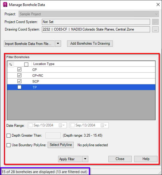
The Geotechnical Modeler tool allows you to sort imported geotechnical sample data by a variety of queries. The various filters include filtering sample data by location type, date range, minimum depth, and polyline boundary. Note the message outlined in blue in the image below. This message will update accordingly each time the filter settings are modified.
To filter imported data by Location Type:
- Open the Manage Data dialog box by selecting Geotechnical Modeler tab
 Geotechnical Modeler Panel Manage Data from the ribbon.
The middle of the Manage Data dialog box provides you a display of the sample
types currently imported into the current drawing in the Select Location Types to
Filter By… section.
Geotechnical Modeler Panel Manage Data from the ribbon.
The middle of the Manage Data dialog box provides you a display of the sample
types currently imported into the current drawing in the Select Location Types to
Filter By… section. - Select the sample type to either include or exclude by selecting the checkboxes next to the Import column from that area.
- Select the Apply Filter button.
- To undo the previous filter selected, clear the checkboxes from the previous step and select Apply Filter or simply select Reset Filter.
To filter imported data by date range:
- Open the Manage Data dialog box by selecting Geotechnical Modeler tab Geotechnical Modeler Panel Manage Data from the ribbon.
There are two date drop-downs located at the bottom third of the Manage Data
dialog box.
- Select the desired start date and end date using the dropdown calendar to filter the data based on those parameters.
- Select the Apply Filter button from the dialog box. The data will now be filtered by the sample date.
- To undo the previous filter selected, clear the checkboxes from the previous step and select Apply Filter or simply select Reset Filter.
To filter imported data by minimum depth:
- Open the Manage Data dialog box by selecting Geotechnical Modeler tab Geotechnical Modeler Panel Manage Data from the ribbon.
- From the bottom third of the Manage Data dialog box select the Minimum Depth checkbox.
- Enter the desired minimum depth value.
- Select the Apply Filter button from the dialog box.The data will now be filtered by the minimum depth value entered.
- To undo the previous filter selected, clear the Minimum Depth checkbox from the previous step and select Apply Filter or simply select Reset Filter.
To filter imported data by polyline:
- Open the Manage Data dialog box by selecting Geotechnical Modeler tab Geotechnical Modeler Panel Manage Data from the ribbon.
- From the bottom third of the Manage Data dialog box select the Use Boundary Polyline checkbox.
- Select the Select Polyline button adjacent to that setting.
- From the viewport select the desired polyline.
- Select the Apply Filter button.
- To undo the previous filter selected, deselect the Use Boundary Polyline checkbox from the previous step and select Apply Filter or simply select Reset Filter. During this process the middle of the Manage Data will provide you with feedback regarding the selection of boreholes displayed in the viewport.
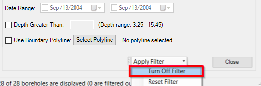
Note:: The Turn Off Filter option is shown below. This option will turn off all filters
while retaining the current filter settings.