
This functionality allows any object or point on the GeoPlan to be geolocalised on common web mapping services or software. A connection to the internet is required.
It may be necessary to set a projection system prior to using web mapping services, and this is map control-dependent:
- In the absence of a map control (None option selected on the GeoPlan page of the Options dialog), it is necessary to specify an online map projection system in order to be able to use online maps with the GeoPlan. For this, select the Set alternative coordinate system option from the GeoPlan menu, and set a projection system in the Alternative Coordinate System Dialog that is subsequently displayed.
- For MapXtreme and ArcGIS Desktop / ArcGIS Engine map controls, this preliminary step is not required as GPS coordinates will automatically be exported in the correct projection system for online use (A default coordinate system is assigned to all the networks within the database, and this default can be changed by the user if required). See Selecting the Coordinate System for more information.
To view a GeoPlan location or object on an online map
- If currently not using a map control, set an online map projection system . See Setting the Alternative Coordinate System for more information. If using a map control, go directly to step 2.
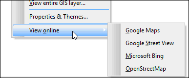
- Click on the location/ object of interest on the GeoPlan, and select View online from the context menu, then choose the desired map service.
Tip:
If several objects are selected on the GeoPlan, only the GPS coordinates of the last object will be used by the online mapping service.
Online map availability on the GeoPlan context menu is configured in the Online Map Options dialog. Supported types include:
- Google™Maps
- Google™ Street View
- Microsoft™ Bing
- OpenStreetMap
- User-defined URL
- The selected web mapping software is launched using the default browser and opens the map with the location / object corresponding to the GPS coordinates that have been clicked on the GeoPlan highlighted on the map. By default, the map will be centred on these coordinates:
In order to use web mapping software it is essential to manually set a coordinate system for databases with no map control specified.
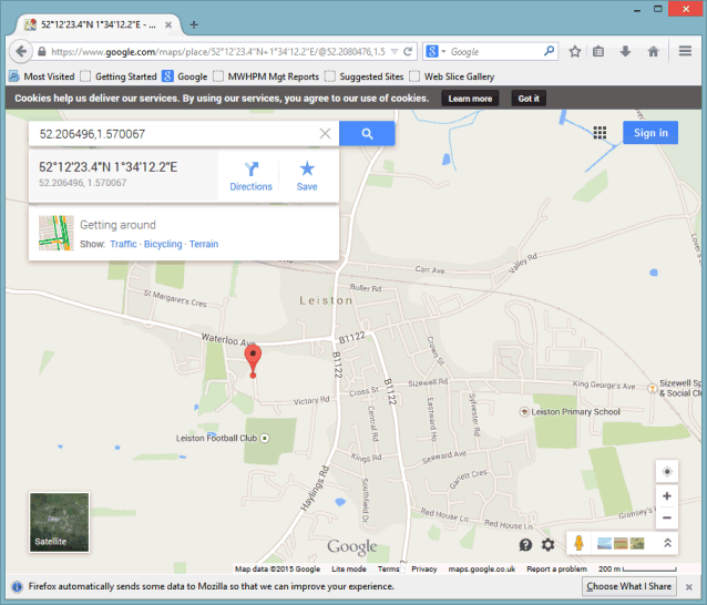
GoogleMaps
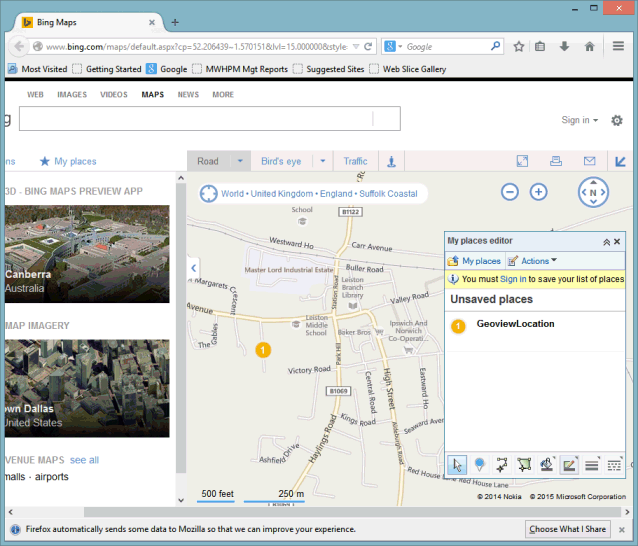
Microsoft Bing