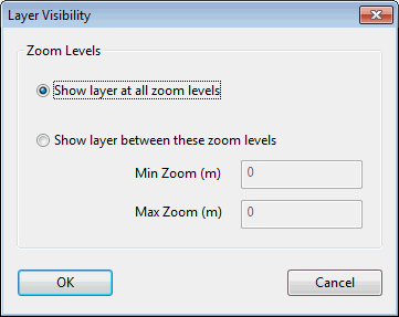
This dialog is displayed when you click the Zoom Levels or the Scale Levels button of the GIS Layer Control dialog.
Tip: Level units (zoom or scale) used for visibility control are set in the
General tab of the
Options dialog.
Use this dialog to specify the level range over which the GIS layer is to be applied.
- Select the desired option. Show layer at all zoom levels is the default option.
- If selecting the Show layer between these zoom levels option, specify the min and max zoom/scale.
- Click OK to commit your changes.