
The Layer Visibility dialog is displayed when the Map Scales button of the GIS Layer Control dialog is clicked.
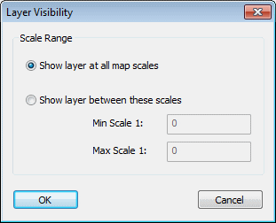
Use the Layer Visibility dialog to specify the level range over which the GIS layer is to be applied.
- Select the desired option. Show layer at all map scales is the default option.
- If selecting the second option, specify the min and max scale.
- Click OK to commit your changes.