
This dialog is displayed as part of the process of
setting subcatchment population counts from address point data or census data. It is displayed when Subcatchment Population data from census areas or SubcatchmentPopulation data from address point counts is selected from the Model menu.
The options on the dialog vary depending on the menu option selected.
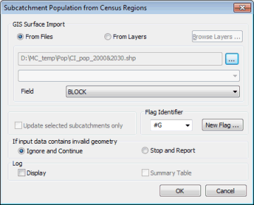
Dialog description
| Option |
Description |
|---|---|
| GIS Surface Import |
The source from which the population data is to be imported. Choices are:
The GIS field containing population data can be selected from the Field dropdown. |
| Update selected subcatchments only | If checked, only the population fields of currently selected subcatchments are updated. |
| Flag Identifier |
Flag to be applied to changed data. An existing flag can be selected from the dropdown or you can click New Flag to display the User Defined Flags dialog. |
| Value for each Point |
Applicable to import from address point data only.
|
| If input data contains invalid geometry |
Applicable to import from census data only.
|
| Log |
Applicable to import from census data only.
|