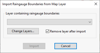
The dialog allows you to select a GIS layer containing rain gauge boundary data from which to import boundaries into InfoWorks ICM. See Spatially Varying Rainfall for more information.
To display the Import Raingauge Boundary dialog, select the GeoPlan menu, and choose:
- Rain gauge data
 Import from map data for
InfoWorks networks
Import from map data for
InfoWorks networks
- Rain gage dataImport from map data for
SWMM networks