
This stage introduces the polygon tool, which is used for marking out permanent areas on the network. Using polygons, you can edit a group of objects or move them to another network.
Creating Polygons
Polygons can be created on the GeoPlan View or the Grid View.
On the GeoPlan
- Ensure that a network is open on the GeoPlan. Either right-click the network in the Explorer window and select Open from the pop-up menu, or drag the network icon into the InfoWorks ICM main window.
- Select the
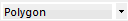 option from the drop-down list on the
GeoPlan Tools Toolbar.
option from the drop-down list on the
GeoPlan Tools Toolbar.
- Click the
 (New object) button on the toolbar. The cursor changes to
 on the GeoPlan.
- On the GeoPlan, click the positions where you want the corners of the new polygon to be, and double-click to complete the polygon.
If the new polygon is directly adjacent to an existing polygon, you can snap individual points to the adjacent polygon, or follow the boundary of the adjacent polygon by snapping a series of points to it. Ensure that the snapping mode
 is switched on if you want to snap points together.
If you want to delete the previously drawn line, press the BACKSPACE key. You can continue to do this to delete each line in turn.
The New Polygon dialog is displayed.
- On the New Polygon dialog, enter a unique name/identifier for this polygon in the ID field. (The node ID will be automatically populated if Automatic Node Name Generation is switched on.)
- Choose the appropriate type of polygon from the Type from the drop-down list. See New Polygon for more information.
- Click
OK. The new polygon is created and displayed on the GeoPlan. The
property sheet
for the polygon is displayed in the Object Properties window.
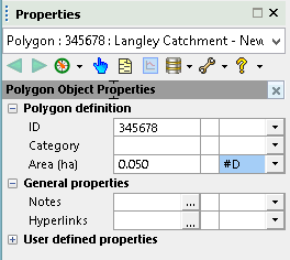
You can enter additional properties on the property sheet now or later.
On the Grid View
- Click the
 (New polygons window) button on the on the
Modelling Grid Windows toolbar. Alternatively, select the
Grid windows | New polygons window from the
Window menu.
(New polygons window) button on the on the
Modelling Grid Windows toolbar. Alternatively, select the
Grid windows | New polygons window from the
Window menu.
- Click the appropriate tab.
- Scroll the grid down until you reach the append row. The append row is marked with a * in the left column. If there is no append row, then the grid may be read-only.
- Edit the properties of the polygon if required. You can type in IDs for polygons you have not yet created. As soon as you start to type the icon changes to
 . You can add other parameters to the append row now if you want.
- To save the new polygon, move off the row you are editing by clicking another row in the grid. If the ID is not unique, a message will be displayed. You must type in a unique ID to identify the polygon. To abort the process, click the
 (Undo) button on the toolbar.
The Polygons Grid is now displayed.
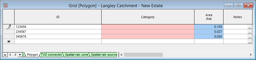
The properties for each type of polygon are contained in separate tabs at the bottom of the grid.
Polygon Example
The following section illustrates how to use the polygon tool on our network example and shows a few other actions that can be performed on a polygon (reshaping a polygon, adjusting values simultaneously for objects of the same type within the polygon, etc).
This stage assumes that you have started InfoWorks ICM and that the Explorer window is open, showing the network icon for the Langley Catchment Study Model Group.
- Open the 'Langley Catchment - Area Re-Zoned' network. Either right-click the network in the Explorer window and select Open from the pop-up menu, or drag the network icon into the InfoWorks ICM main window.
- Display the background map if it is not already displayed. Right-click the GeoPlan, select the GIS Layer control... option from the context menu, click 'MapC' in the GIS Layers list, add a check in the Visible box and click OK.
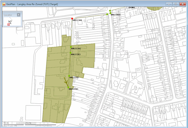
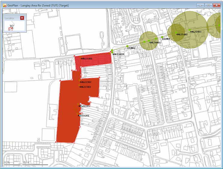
- Zoom in on the south-west of the network.
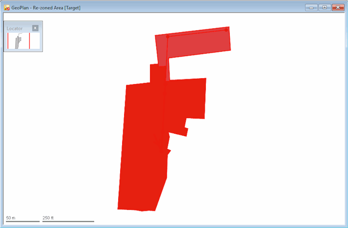
Subcatchment area '44622201' is to be re-zoned, removing it from the current network for inclusion in another network.
- Add a polygon:
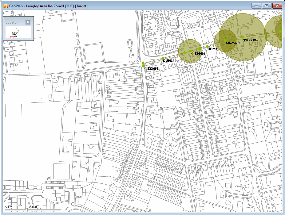
- Zoom in closer, so that you can clearly see the housing estate to the south of the node '44622301'. You can, for example, use the Find in GeoPlan option in the GeoPlan menu to zoom to the node. In the dialog, enter the node id, in this case, 44622301, and click the Find button, and the GeoPlan will be centred on the specified node.
- Click the
(New object) button and ensure that the' Polygon' option is selected from the
New Object Type drop-down list on the
GeoPlan Tools Toolbar.
- Mark out an area containing the development area to the east of '44623301'. Ensure node '44622301' and link '44622301.1' to the north-west of the development area are included in the polygon. If necessary, use the auto-panning feature when the pointer is at the edge of the GeoPlan and turns into a large arrow, click to scroll a short distance in that direction to include areas not currently visible on the GeoPlan.
- Double-click to complete the polygon, and the
New Polygon dialog is displayed.
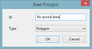
- Enter the name 'Re-zoned Area' into the ID field.
- Click
OK. The dialog closes and the object properties window for the polygon is displayed.
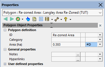
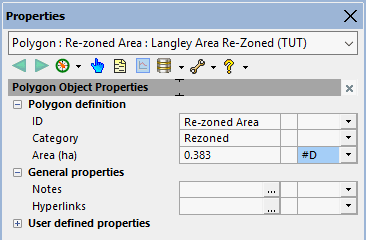
- Enter 'Rezoned' in the
Category field.
- Use the
 (Select) tool to select the polygon. Click anywhere inside the polygon.
A Multiple Selection dialog may be displayed so ensure that you select 'Re-zoned Area' from the list.
- Use the
 (Edit object geometry) tool to change the polygon boundaries to include node '44622301' and link '44622301.1' at the north of the polygon:
When adding further polygons, the points that you add will automatically 'snap' to the corners of nearby polygons, unless you specify otherwise. To turn snap mode off (or back on again) press the
S key or click the
Use Snap Mode button
on the toolbar.
(Edit object geometry) tool to change the polygon boundaries to include node '44622301' and link '44622301.1' at the north of the polygon:
When adding further polygons, the points that you add will automatically 'snap' to the corners of nearby polygons, unless you specify otherwise. To turn snap mode off (or back on again) press the
S key or click the
Use Snap Mode button
on the toolbar.
- Click the polygon and then drag the polygon corners to new positions.
- Hold down the CTRL key and click the polygon border to add new bends.
- Change the value in User Text 1 to Test for all
nodes in the polygon. Note that the values of all the objects of the same type included in a polygon can be edited at once. Therefore, to change the value:
- Select all the nodes and links using the Select Objects in Selected Polygons option from the Selection menu.
- Select the
Selection operations | Adjust selected values...
option. The
Adjust Selected Network Values dialog is displayed.
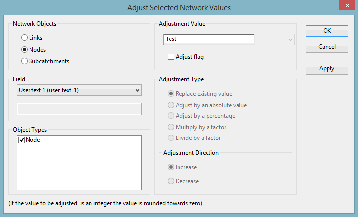
- Select Nodes in the Network Objects pane.
- Select 'User Text 1' from the list in the Field pane.
- Type 'Test' in the box in the Adjustment Value pane.
- Click
OK. The
Adjust Selected Network Values dialog closes and a confirmation message is displayed.
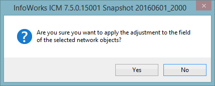
- Click Yes to confirm the changes.
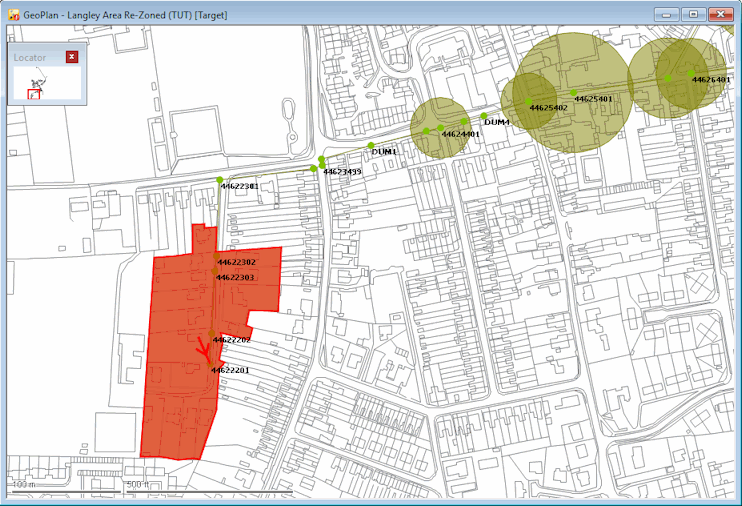
- The objects in the polygon can now be copied to a new network:
- Create a network called 'Re-zoned Area' in the Langley Catchment Group. Right-click 'Langley Catchment Study' model group, in the Explorer window and select New InfoWorks | InfoWorks network from the pop-up menu. Type 'Re-zoned Area' the Name field in the New Name dialog, and click OK.
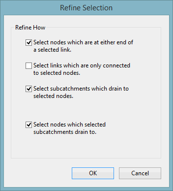
- In the current network (the network opened in Step 1), use
Selection | Refine Selection... to check that the selected objects form a viable group.
This option ensures that there are no links that do not have a node at each end, that subcatchments draining to any of the nodes are included, and that nodes which the selected subcatchments drain to are also included.
The Refine Selection dialog is displayed.
- As the defaults are suitable, click OK.
- Select the Copy object(s) options from the Edit menu to copy the nodes and links.
- Open the new 'Re-zoned area' network. Either right-click the network in the Explorer window and select Open from the pop-up menu, or drag the network icon into the InfoWorks ICM main window.
- Select the Paste object(s) options from the Edit menu to paste the copied the nodes and links into the 'Re-zoned area' network.
- Commit the changes to the 'Re-zoned Area' network (without validation).
- Now that the polygon has been copied onto the new network, the re-zoned objects can be deleted from the original network:
- Right-click anywhere on the 'Langley Catchment - Re-Zoned Area' network (the original network opened in Step 1).
- Select the
Selection | Selection operations | Delete All Selected Objects option from the pop-up menu. A progress window is displayed while the selected polygon is being removed.
- Commit the changes to the network (no need to validate)
- Close the GeoPlan view by clicking the
 button in the top right-hand corner of the window.
 Back to flowchart